
DJI will present to the world the new Phantom 4 tomorrow March 1 at 11:40 am EST. A week ago a teaser video was published on Youtube by the drone manufacturer. Keep reading for what we speculatively know about the new features.

DJI will present to the world the new Phantom 4 tomorrow March 1 at 11:40 am EST. A week ago a teaser video was published on Youtube by the drone manufacturer. Keep reading for what we speculatively know about the new features.
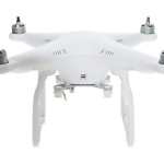
Some time ago, before getting my drone, I was researching the complete measurements of the Phantom 3. I got the info here and there, but it took a while. Here are all measurements of the Phantom 3 in imperial (inches) and metric (centimeters), if you were also wondering.

Lets say your website page is already loaded but you need to poll your database for some extra info, or to check for an update on something. The way to go is using Ajax. jQuery makes working with Ajax really easy and even better if you return your data using Json.

Litchi, the DJI’s Phantom 3 and Inspire software to control your drone, developed by VC Technology Ltd, got an update today to version 3.0.1 (Android) and 1.3.0 (iOS).
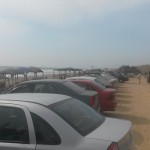
Engabao is located just 10 kilometers west away from General Villamil Playas. A quiet beach in the Guayas province that offers relax and food for tourists that do not want to get too far from Guayaquil.
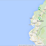
Here is some short code to setup Google Maps on your site pretty fast. The map markers are grabbed through ajax using jquery from a php file. The example php provided contains an array of markets based on the ajax query. This, of course, should be changed with your own.

So your website has now thousands of visitors? Well, congratulations… but your system processor is probably on a huge load if you haven’t added any caching options. Here is PHP to the rescue.
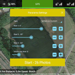
You know you want to share your drone photography with the world. One cool way is to take 360 photographs one step further, or.. higher. An app called Litchi lets you do just that. Place your aircraft in one cool place, choose some options and there, a bunch of images that combined can become one 360 picture to be uploaded to Panoramio.com and into Google Maps/Earth.
